Aljezur
Aljezur is a small hill town in the far west of the Algarve, under a castle on a schist hill. Its coast of more than 40 km lies on the Costa Vicentina.
- CoastMore than 40 km
- Blue Flag 20264 beaches
- Castle10th century
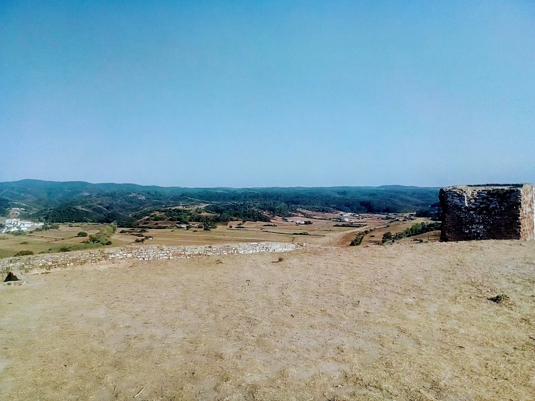
Photo: Girassolei, CC0
Castle, coast and park
The town has a castle above it and a long coast below. The natural park protects the Costa Vicentina.
- The municipality has more than 40 km of coastline.
- Four beaches in the municipality hold a 2026 Blue Flag: Amoreira-Mar, Arrifana, Monte Clérigo and Odeceixe-Mar.
- The Parque Natural do Sudoeste Alentejano e Costa Vicentina protects the coast.
- The Rota Vicentina walking route passes through Aljezur.
Checked November 2026: Câmara Municipal de Aljezur, PraiasABAE, Blue Flag 2026 (Aljezur)Câmara Municipal de Aljezur, Natureza e biodiversidadeRota Vicentina association, The RegionCâmara Municipal de Aljezur, Passeios pedestres
- Castelo de Aljezur
- Amoreira
- Monte Clérigo
- Arrifana
- Fortaleza da Arrifana
Beach points from the ABAE 2026 list. The castle and the Arrifana fortress use the council's and the heritage register's own coordinates.
Map: our drawing from © OpenStreetMap contributors data (ODbL), 2026-10-29.
Three Blue Flag beaches
Each of these three beaches has a 2026 Blue Flag and lifeguards from 1 June to 30 September.
| Beach | What it is |
|---|---|
| Praia da Arrifana |
|
| Praia de Monte Clérigo |
|
| Praia da Amoreira |
|
- Lifeguards work from 1 June to 30 September.
The castle, the fortress and the walks
A ruin on a hill, a fortress above a bay, and two walks.
- CastleCastelo de AljezurThe Arabs built it in the 10th century. The town's foundation is attributed to them.It was part of Silves' defences in the 12th and 13th centuries.It was the last Islamic castle in the Algarve. Christians took it in 1249, under D. Afonso III.Two towers remain: a round one to the north and a square one to the south.It lost its use in the late 15th or early 16th century and fell into ruin.
- ProtectedImóvel de Interesse Público
- Setting
- On a schist hill above the town
- View
- The Aljezur plain and the Monchique range
- FortressFortaleza da ArrifanaBuilt in 1635 under D. Gonçalo Coutinho, to defend the coast and the tuna trap at the bay.It is a natural viewpoint over Praia da Arrifana and the Costa Vicentina.
- WalkCircuito Histórico-Cultural e Ambiental de AljezurAbout 4 km, taking about 2 hours. The trail is PR1 AJZ.
- Long walkRota VicentinaA walking route in the south-west of Portugal, from Santiago do Cacém to Cabo de São Vicente.The route passes Odeceixe, Aljezur, Arrifana and Carrapateira.
- Coast
- About 110 km of wild coastline (association)
- Whole route
- 350 km (council)
- ParkParque Natural do Sudoeste Alentejano e Costa VicentinaIts plan sets the activities allowed in each protection zone, including hiking and nature observation.
Checked November 2026: Câmara Municipal de Aljezur, Castelo de AljezurPatrimónio Cultural, Castelo de AljezurCâmara Municipal de Aljezur, Fortaleza da ArrifanaCâmara Municipal de Aljezur, Passeios pedestresRota Vicentina association, The RegionICNF, Parque Natural do Sudoeste Alentejano e Costa Vicentina, Plano de Ordenamento
A day in Aljezur
The castle first, then the coast.
Morning: the castle
Climb the schist hill above the town. The view covers the Aljezur plain and the Monchique range.
Midday: Arrifana
Visit the small bay under the high cliffs. The fortress above it looks over the beach and the Costa Vicentina.
Afternoon: Monte Clérigo
Walk the sand, then the rock platform at low tide, where the pools hold marine life.
Getting to Aljezur
Sagres lies south along the coast. Monchique and Silves lie inland.
- From Faro airport109 km, about 85 min
- From Lagos34 km, about 40 min
- From Portimão48 km, about 45 min
By car without traffic, our estimate from OSRM routing on OpenStreetMap roads, 2026-10-29.
Aljezur questions
Where is the castle?
On a schist hill above Aljezur, with views over the valley and the Monchique range.
How old is the castle?
The Arabs built it in the 10th century. Christians took it in 1249, under D. Afonso III.
Which Aljezur beaches have lifeguards?
Arrifana, Monte Clérigo and Amoreira, from 1 June to 30 September.
What is the Rota Vicentina?
A walking route in the south-west of Portugal, from Santiago do Cacém to Cabo de São Vicente. It passes through Aljezur.
A day on the west coast, planned.
Tell us the date and who is coming, and we will plan the castle, the beaches and a walk with you.